Using the Hamm seismograph app to "see" underground
To find natural gas and oil beneath the earth's surface, geoscientists can use seismic technology. Seismic imaging bounces sound waves off underground rock structures to reveal possible natural gas and oil–bearing rock formations. Paul McMasters of Manchester Middle School used the Hamm seismographic app to create lessons related to this technology, helping students learn basic principles of geophysics. "We also threw in a robot for good measure," said McMasters.
"We were not able to complete the lessons prior to shutdown. However, the seventh grade research and design student teams were able to complete the design and testing phase. These teams participate in designing and testing new lessons. It's a great enrichment activity, and it avoids making guinea pigs out of the whole seventh grade."
McMasters attended the OOGEEP STEM teacher workshop and developed a modified version of lesson 3.1 Sound Boards using the Hamm Seismograph app to locate a paleochannel in a sound box. The app measures displacement of a cell phone in the x, y, and z directions in response to ground motion. Students simulate the vibroseis technique by tapping (simulating a thumper truck) on the materials and recording the displacement of their phones (acting as a geophone). Using foam and wood models, the students would develop an exploration technique that can be used to locate the paleochannel in the sound box.
The results from this exploration allow them to construct a paleogeographic map of the paleochannel, and locate three potential drilling locations (i.e., sandbars) on the map. Grid locations with foam represent sandstone, whereas locations with wood represent shale.
Lesson 1: Hamm Seismograph
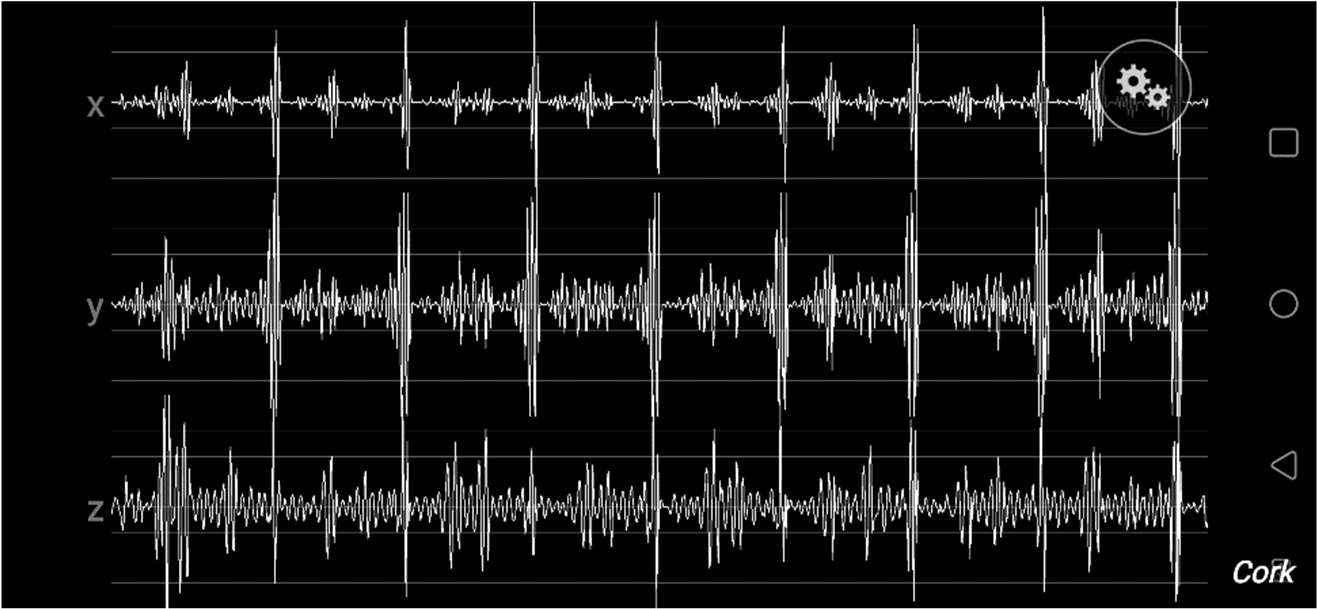
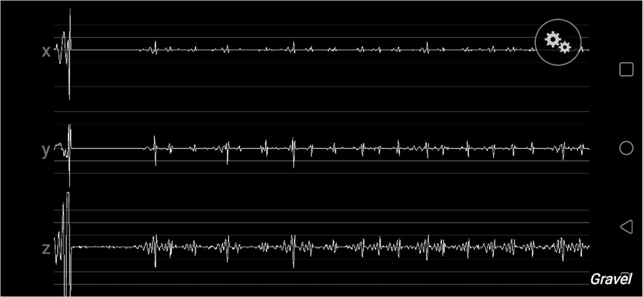
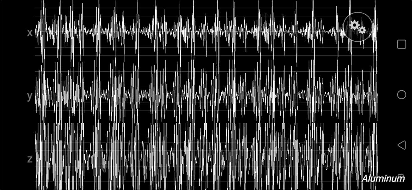
Summary: Students will use the Hamm Seismograph app to investigate the unique patterns of vibrations that occur when kinetic energy is transferred through solids. Students will place a cell phone on the material (e.g., steel plate), and tap the material. The cell phone will use the Hamm Seismograph app to record vibration in the x, y, and z directions. Students will create a screenshot catalog showing the unique signatures of each material. Students will also complete a graphic organizer that illustrates the connections between electrical conductivity, thermal conductivity, and kinetic energy in the materials.
Cork
Gravel
Aluminum
Lesson 2: Mystery Boxes
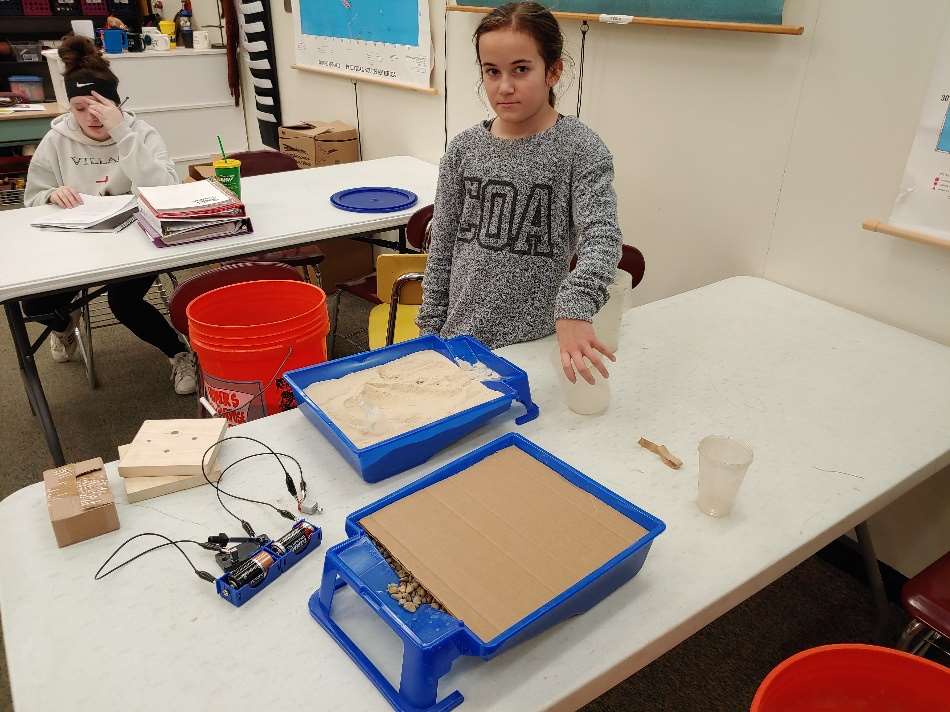
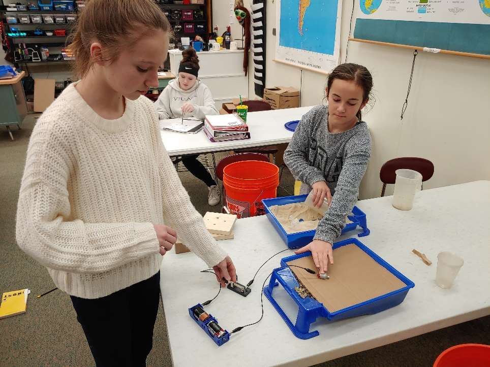
Summary: Students will use the Hamm Seismograph app to identify sediments in boxes. This lesson introduces the role of seismic investigation in identifying subsurface materials. The boxes consist of a plastic paint tray filled with sediment and covered with cardboard so the contents are not visible. The boxes were designed and tested by the eighth period student R&D team.
During part 1, students will create a Hamm screenshot catalog for gravel, sand, and silty clay by using a motor to vibrate the cardboard. During part 2, students will compare the Hamm screenshots to their catalog to identify the sediments in the mystery boxes.
R&D Team 8 constructing sand and gravel boxes.
R&D Team 8 testing the motor.
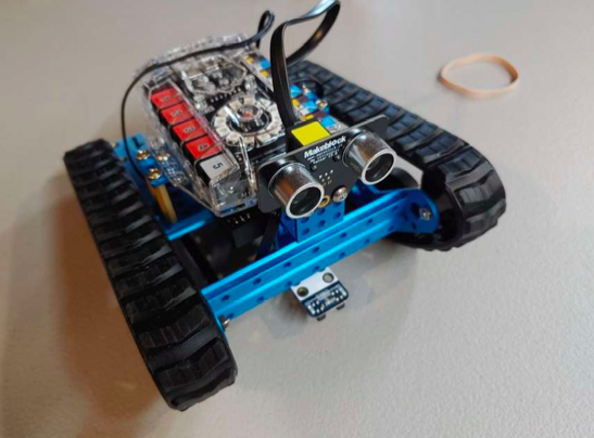
Lesson 3: Thumper Buggy
Summary: During this lesson, students will:
- Design a pull-behind platform that incorporates a vibrating motor
- Program an mBot Ranger to pull the platform along a traverse
- Analyze Hamm Screenshot output along a traverse
Students will construct a network of geophones (cellphones) and use the screenshots to identify materials along a traverse. The seventh period R&D Team designed a prototype platform to house the vibrating motor, batteries, and a switch. The platform is designed to be pulled behind an mBot Ranger.
Vibrating motor
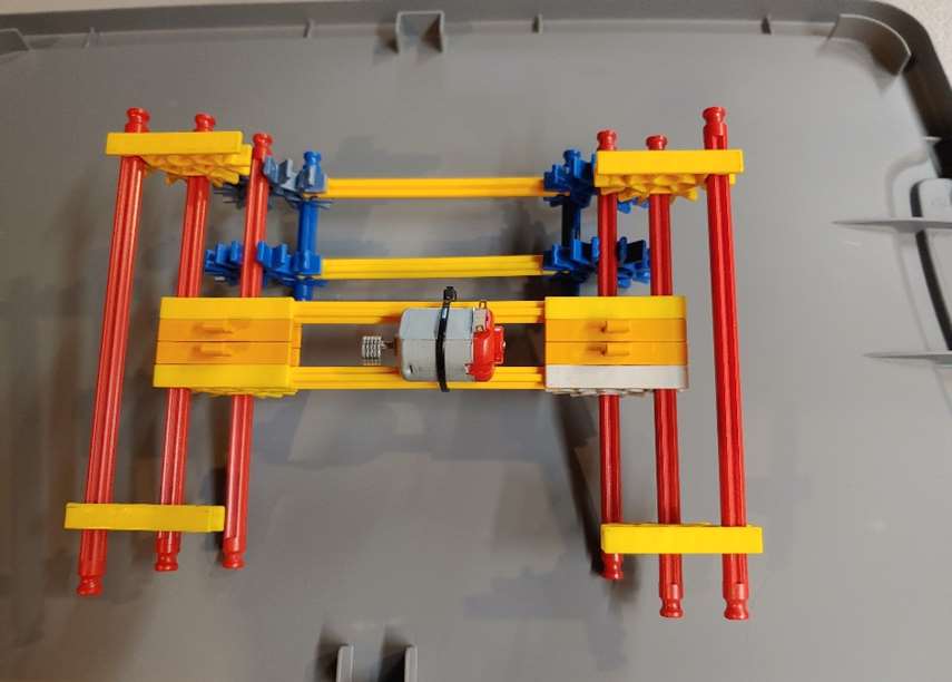
mBot Ranger